

נזלת עיסא
| טריטוריה |
|
|---|---|
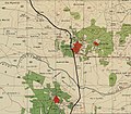
נזלת עיסא (בערבית: نزلة عيسى) הוא כפר פלסטיני בנפת טולכרם במערב השומרון, הממוקם כ-17 ק"מ צפונית לטולכרם. על פי הלשכה הפלסטינית המרכזית לסטטיסטיקה, אוכלוסיית נזלת עיסא מנתה בשנת 2006 כ-2,502 תושבים.[1] 8.7% מאוכלוסיית נזלת עיסא היו פליטים בשנת 1997.[2]
היסטוריה
קרמיקה מהתקופה הביזנטית נמצאה בכפר, כמו גם בורות מים וקברים.[3] במפת הקרן לחקר ארץ ישראל שפורסמה ב-1882, נזלת עיסא תואר כ"כפר קטן על הגבעות הנמוכות, עם בארות."[4]
במפקד האוכלוסין של ארץ ישראל משנת 1922 שנערך על ידי שלטונות המנדט הבריטי, מנתה נזלת עיסא 203 מוסלמים.[5] מספר זה גדל במפקד 1931 ל-261 תושבים שהתגוררו ב-62 בתים.[6] בסקר הכפרים של 1945 אוכלוסיית נזלת עיסא מנתה 380 מוסלמים,[7] על שטח של כ-2,030 דונם.[8] מתוך שטח זה, 684 דונם נועדו למטעים וקרקע להשקיה, 750 שימשו לגידול דגנים,[9] ואילו 12 דונם היו אדמות בנויות.[10]
בשנת 1961 אוכלוסיית נזלת עיסא מנתה 627 תושבים.[11]
בשנת 2003, במהלך האינתיפאדה השנייה, נהרסו מעל 60 חנויות על ידי דחפורים של הממשל הישראלי. מתוך טענה שהן נבנו ללא היתר.[12][13][14]
-
 נזלת עיסא 1942 1:20,000
 -
 נזלת עיסא 1945 1:250,000


הערות שוליים
- ↑ Projected Mid -Year Population for Tulkarm Governorate by Locality 2004- 2006 Palestinian Central Bureau of Statistics.
- ↑ Palestinian Population by Locality and Refugee Status Palestinian Central Bureau of Statistics
- ↑ Dauphin, 1998, p. 755
- ↑ Conder and Kitchener, 1882, p. 47
- ↑ Barron, 1923, Table XI, Sub-district of Tulkarm, p. 27
- ↑ Mills, 1932, p. 56
- ↑ Government of Palestine, Department of Statistics, 1945, p. 21
- ↑ Government of Palestine, Department of Statistics. Village Statistics, April, 1945. Quoted in Hadawi, 1970, p. 76
- ↑ Government of Palestine, Department of Statistics. Village Statistics, April, 1945. Quoted in Hadawi, 1970, p. 127
- ↑ Government of Palestine, Department of Statistics. Village Statistics, April, 1945. Quoted in Hadawi, 1970, p. 177
- ↑ Government of Jordan, 1964, p. 27
- ↑ "Israelis flatten West Bank shops". BBC News. 21 בינואר 2003.
{{cite news}}: (עזרה) - ↑ HEPG (במרץ 2004). "The Impact of Israel's Separation Barrier on Affected West Bank Communities" (PDF). Humanitarian Emergency Policy Group (HEPG). אורכב מ-המקור (PDF) ב-2008-02-28.
In preparation of the new route of the Barrier in Nazlat Isa, the IDF demolished more than 120 shops during August 2003. A second demolition of 82 shops was completed by the IDF in January 2003. Storeowners were given as little as 30 minutes to evacuate their premises before the demolitions started. Apart from Tulkarm town, Nazlat Isa was the main commercial centre for the Tulkarm area and was heavily dependent on commerce with Israel.
{{cite web}}: (עזרה) - ↑ James Bennet (2003-01-22). "Israel Destroys Arabs´ Shops in West Bank". New York Times.
Jan. 21 – The Israeli Army used bulldozers to flatten dozens of shops today in one of the few thriving Palestinian commercial centers near the West Bank boundary, saying that the store owners lacked permits.
 | ||
|---|---|---|
| ערים | טולכרם (מכילה את השכונות: שוויכה, אירתח) | 
|
| מועצות מקומיות | ענבתא • עתיל • בלעא • באקה א-שרקייה • בית ליד • דיר אל-ע'וסון • קפין | |
| כפרים | פרעון • איכתאבא • עילאר • עזבת שופה • אל-ג'ארושיה • כפר עבוש • כפר ג'מאל • כפר א-לבד • כפר רמאן • כפר סור • כפר זיבאד • ח'רבת חורייש • כור • א-נזלה אל-ע'רביה • א-נזלה א-שרקיה • נזלה אל-ווסטא • נזלת אבו נאר • נזלת עיסא • רמל זיתא • רמין • א-ראס • ספארין • סידא • שופא • סיר • זיתא | |
| מחנות פליטים | נור שמס | |
| נפות הרשות הפלסטינית | ||

נזלת עיסא31183765